Top apps you need to go boating
How-to
Feb 26, 2025

Here are our top picks of the apps you need in your pocket for a successful day on a powerboat, or a long sailing passage offshore.
Whether you are taking a small boat out to the local sandbar with your family, or crossing oceans, there are a few tools all of us at SeaPeople have in our pocket, to make our time on the water as safe, well planned, and as fun as possible.
Navigation | Navionics Boating App
Navionics still reigns supreme in the mobile navigation space. Whether you use it simply for trip planning and route exploring, or use it as your primary navigation tool, it's hard to imagine life without Navionics in 2025.

TRIP PLANNING - Navionics' route creator is a simple tool that allows you to calculate the distance to your next destination, estimate the time it will take you to arrive, and plan for fuel burn. All while looking at quality water depth data to ensure you are taking the safest route for your vessel. We love the quick and easy route builder is to use.
NAVIGATION - Safe navigation is everyone's goal. Well almost everyone's (we all have seen them 😉). Knowing where you are at all times, knowing what lies ahead, and feeling confident that you are navigating in deep enough water to stay off the bottom are the simplest goals for a safe and stress free day as a sailor or powerboater. If you have a bigger vessel with a built in chart plotter/ navigation tool, Navionics still offers a great 'second opinion.' Logan, one of the SeaPeople co-founders says: "In new areas, tight waterways (ICW), or shallow regions, I almost always keep Navionics open as well as my built in plotter. I quickly reference both constantly. If they are telling me the same thing, I am at peace. If they aren't aligning, I slow down, take a closer look at both, use my eyes on the water, and make informed navigation decisions. As an uptight (but right) instructor would say: 'a prudent mariner never trusts a single source.' I also use Navionics to quickly mark places we catch fish or find lobsters when out on the small boat."
Weather | Windy App
Windy has won the boating world over in the last couple years with their powerful weather app. They have an incredible suite of weather tools that most of us at SeaPeople, only a year ago, would have spent hours scouring separate websites to get the same information. Here are our top Windy tools that make it the easy choice for us as the top weather app for boaters.
Easy to read wind forecasts on a global map. This makes it easy to get a quick view of whats coming.
Easy to read wave / swell forecasts on a global map.
Easy toggling between European, GFS, and other weather models. Giving you more than one opinion.
Realtime reported wind from shoreside stations as well as bouys. Very important for those last minute checks before departure.
Webcams shown right on the weather map. Get an idea of what the lake, waterway or ocean actually look like before departing.
Tide forecast overlays right not the weather map.
Radar maps for realtime cloud cover, rain, squall, and an overall check of whats coming your way.

Communication & Sharing | SeaPeople
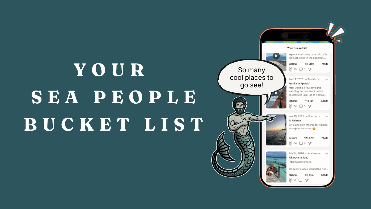
Within four months of launch, SeaPeople has over 60k active boaters communicating on the water. Sharing important navigation updates in real-time, requesting assistance, planning simple gatherings on sandbars and beaches, and staying connected when they are off the water in groups.
TIMES ARE CHANGING - As connectivity for boaters gets better and better thanks to advances in 5G, cooperation between wireless carriers across borders, new providers like GoogleFi, and satellite connectivity with Starlink, we are entering a new era for connecting boaters on and off the water. Here are the top way we use SeaPeople to stay connected and communicate with people around us.
Hails - Our version of VHF radio. But our hails stick around for up to 48 hours (you choose the expiration depending on your message purpose) allowing your message to really be seen and heard. Use them for quick updates on navigation hazards, seek local knowledge, or plan a happy hour; anything you would have tossed on the VHF (other than emergencies), but with less barriers and more visibility. Learn more about Hails.
Chats - Chats seem like a simple tool that would easily be done on your phone's message center or WhatsApp, but boaters that chat on SeaPeople have access to an incredible mapping tool. Allowing them to see where the other chat participants are on a drag down map right in the chat thread. Never ask 'where are you' ever again. Learn more about Chats.
Groups - There are hundreds of groups in SeaPeople. Boat owners groups, advice groups for things like getting into boating or boating with children or pets (our other children), sailing clubs, and so much more. SeaPeople groups offer you a powerful communication tool to stay in touch with your friends, make new friends, get the advice you need, support the community with your experiences, and do it all without the distractions and noise on FaceBook. Learn more about SeaPeople Groups.

SeaPeople is the most powerful tool you can put in your pocket to connect with new people in the boating community, get involved in boating as a newbie, and communicate effectively on the water. Yeah, we built it… but because we needed it and we use it every day!
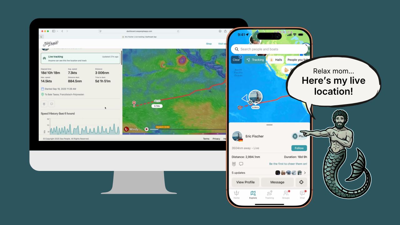
Live Position Sharing
Your friends and family want to know you are safe and want to enjoy your adventures with you. There are two great ways to share live in SeaPeople.
1) Live trip sharing in the app. Whenever you start tracking in SeaPeople you have the option to 'go live while tracking.' This gives you a great opportunity to share you live trip to your friends in the app. Your trip will show up on the top of their feed where you can quickly use comments to give updates, they can comment to interact underway, and also give you kudos. Learn more about live trip sharing.

2) Live trip sharing to the web. We know all your friends, family, and followers don't have SeaPeople. So we have built a powerful web app where you can send them to check out your live trips online. There are weather overlays, stats, destination lines, and of course your past trackline so they can see where you started. Learn more about live web sharing.