Route Planning Meets Weather
Product updates

Plan your route. See the weather along the way.
You’ve picked your next destination. Now comes the part that can mean bouncing between apps: checking the wind, looking at the waves, and figuring out when to leave.
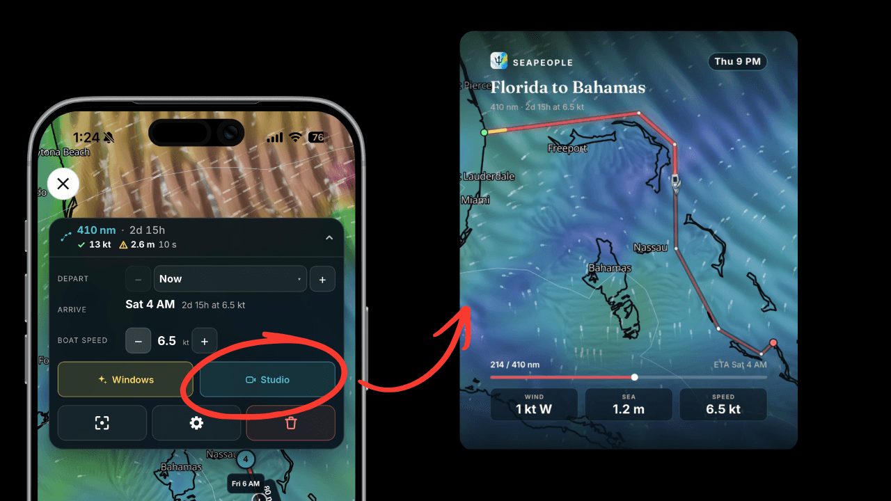
With weather forecasts built into route planning, you can see the conditions forecast along your planned journey, set your own comfort limits, and find a departure window that works for you.
All part of our Premium Marine Weather tools and free for everyone for the next 100 years!
See The Forecast Along Your Route
Route Planning lets you see the forecast along your planned journey, helping you understand how wind and waves are expected to change along the way. Whether you’re planning a short hop to the next anchorage or a longer passage, you can bring the weather into your decision from the start.
The free Premium Weather tools include forecasts up to 10 days ahead, with hourly detail for the first 48 hours, and information on wind, gusts, waves, and precipitation. That gives you a longer view while you’re exploring options and a closer look as departure approaches.

Find A Better Time To Leave
Once you know where you want to go, the next question is when.
The departure-window tool helps you find a day and time when forecast conditions match your comfort preferences. With personal comfort thresholds, you can set the wind and wave conditions you’re comfortable with. You can use it alongside the route forecast to assess your options before settling on a plan.
Could leaving later make for a more comfortable passage? Having your route, forecast, and comfort limits together makes those decisions easier to work through.

Share Your Float Plan With Friends And Family
Once you’ve chosen your route and checked the weather, create a float plan in the Studio to share with friends or family so they know where you’re heading and when you expect to arrive.
Keeping someone ashore informed is a simple part of safer trip planning, giving them a plan to refer to if you don’t arrive or check in as expected.